from 0 review
Daily Tour
Unlimited
English
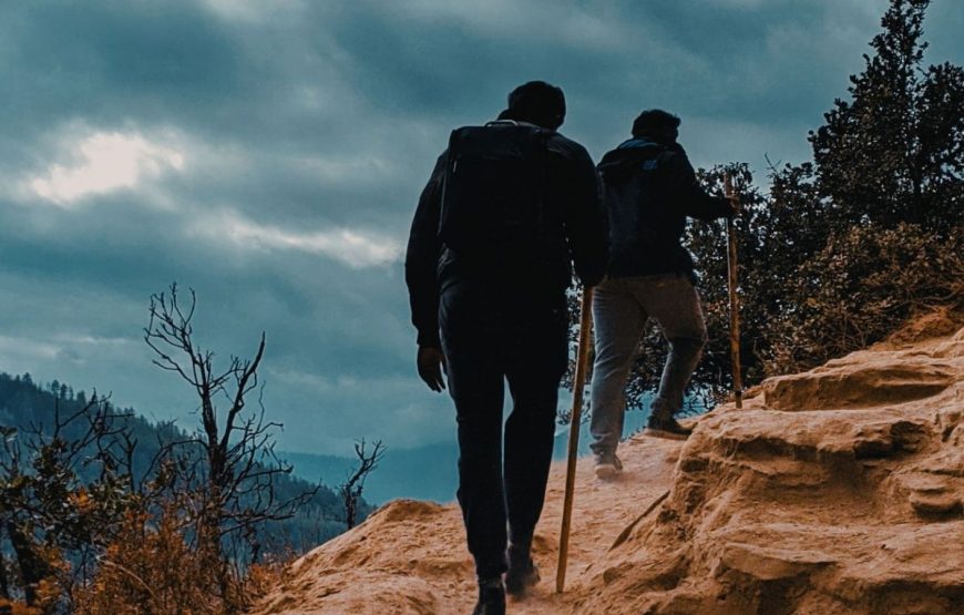
The Snowman trek is frequently closed because of snow and is almost impossible during winter. The recommended season for this trek is mid-June to mid-October.
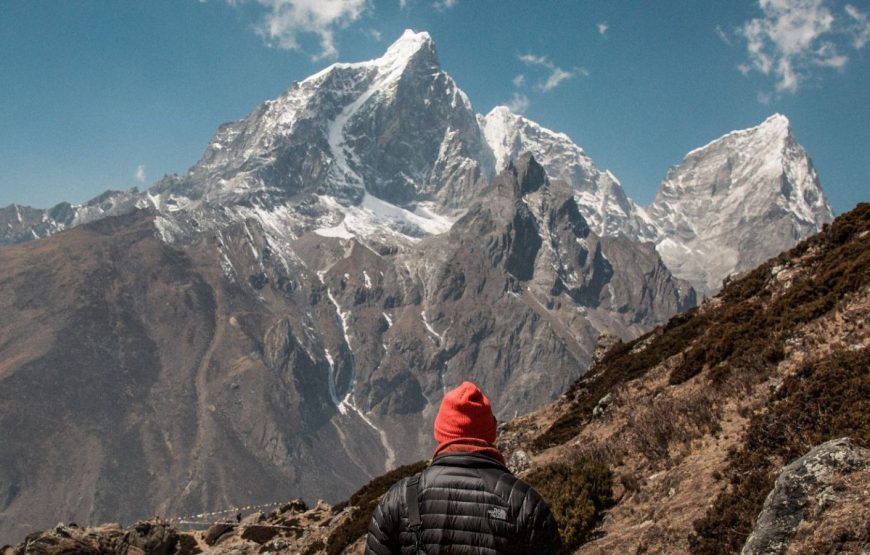
Snowman Trek in Bhutan is one of the most beautiful treks in the whole Himalayas. Billed as the most difficult trek in the world due to altitude, duration and distance, far more people climb Mount Everest in Nepal than completing this alpine quest. Many returns incomplete due to altitude sickness. The trek goes on northern Bhutan along the border with Tibet crossing thirteen Himalayan mountain passes some as high as 5000m. You will have spectacular mountain views of Jumolhari, Jichu Drake, Masangang, Tiger Mountain and Gangkar Puensum and other conspicuous peaks along the norther border.
This trek covers the remote Lunana district and is considered as the most challenging trek in Bhutan. The attributes that make it a tough trek are; distances, altitudes, weather and remoteness.
On arrival at Paro airport, received by our representative and transfer to Thimphu, Bhutan's capital town.
Overnight at the hotel in Thimphu.
Full day city tour including visits to the Memorial Chorten, Trashichho dzong, National Library, Art School, Traditional Medicine Institute, Handicrafts Emporium and Textile and Folk Heritage Museum.
Overnight halt at the hotel in Thimphu.
Drive to Punakha via Dochula pass (3,050m), through magnificent forest of rhododendron and magnolia. From the pass one can have the panoramic view of eastern Himalayan peaks and enticing view of Lunana route, Picnic lunch at Punakha by the riverside. Enjoy the view of Punakha Dzong, built in 1637 during the time of Zhabdrung. The Dzong is now used as the winter residence of monk body and administrative centre of the district. After lunch drive on to Tashithang following the Mo Chu river.
Camp at Tashithang at the end of the road at alt. 1,600m.
The trek starts by the riverside, following a well-made path through semi tropical forest. This part of the area is quite wet and one has to be careful of leeches. Also, for flower lovers there is abundant on wild orchids here. The day walk is fairly gentle climbing up to Damji village.
Camp at Damji at alt. 2,250m, walking time 5/6 hours.
The path continues through semi-tropical forests and villages up to Gasa Tshachu (hot spring). The Tshachu is a famous place where people from all over the country come to have bath, due to its curative powers. Here there are four pools of different temperature from mild to hot. Hot lunch will be served close to spring. After lunch two hours stiff climb to Gasa Dzong.
Camp below the Dzong at alt. 2,900m.
Walking time 6/7 hours.
After breakfast, visit the Dzong, which was built in 17th century, to protect the valley against Tibetan invaders. The path starts with stiff climb up to Belela pass (3,700m) through bamboo, rhododendron, juniper and fir forests. Then descend for about half an hour to camp at Chamsa at alt. 3,650m. Walking time 6/7 hours.
The trail starts by descending to the bank of Mo Chu river. Lunch will be served at the side of bridge, across the river. After lunch climb gradually to Laya crossing the army camp.
Overnight camp at altitude of 3,800m.
Walking time 8/9 hours.
One can go around the villages, visiting houses and the people. Laya people are very friendly and will happily pose for photographs. Women of Laya wear a special dress and typical bamboo hats, decorated with turquoise and silver ornaments. Cultural evening with dances performed by local girls.
From Laya descend to army camp and continue following the river till the turn off point to Rhodophu. After lunch continue the climb through rhododendron bushes till reach the camp at alt. 4,350m.
Walking time 8/9 hours.
The path is flat for another four hours till climb to Ganglapachung pass (5,080m) is started. The view from the path is breathtaking and whole range of mountains including Masagang, Tsendegang, Teri gang can be seen. After the path, it is very long descent to Tarina valley.
Camp at altitude of 3,980m.
Walking time 10/11 hours.
The walk leads down through conifer forests following the upper reaches of the Pho chu river. The trail then climbs over a ridge and drops to Woche at 3,800m, the first village after Gasa.
Camp at alt. 3,800m.
Walking time 6/7 hours.
The trek starts through juniper and fir forests and further ahead through rhododendron bushes. Climb up to Keche la pass (4,480m) where one can have the great view of mountains. After the pass, descend to the riverside walking through the village with stunning view of Table Mountains and others. Follow up the river till Lhedi village, which is one of the main sources of Pho Chu river.
Camp at alt. 3,650m.
The trek continues following the river, rising gradually to Choejong village. After lunch, visit the Choejung village walking towards the wide valley. Cross the bridge to reach Thanza camp at alt. 4,000m, walking time 7/8 hours.
One can walk around or climb the ridge for fascinating view of lakes and mountains.
The trek starts by climbing the ridge, with great view of the Table Mountain and Thanza valley below. The ridge alt. Is 4,500m and it rises gradually up-to 4,650m. After lunch walk upwards the left side of the bridge enjoying the view of snowcapped mountains. Further after climbing ridges, you reach the camp site of Tshorim at alt. 5,125m, walking time 8/9 hours.
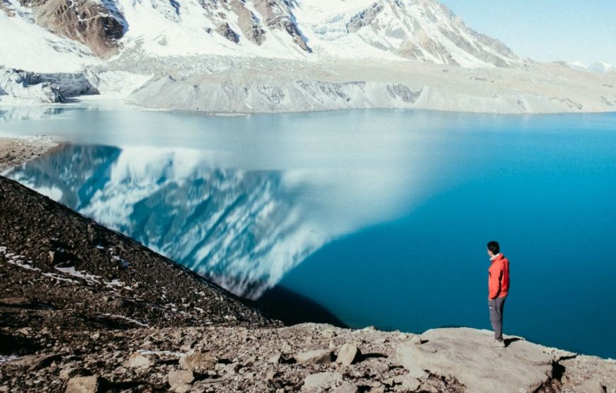
This is one of the highlights of the trip and day starts with a short climb to the Tashorim Lake. Walk on the side of the lake enjoying the panoramic view of Gophula ranges. The last climb to the Guphola pass (5,230m) is very short. After the pass descend to the base camp, walking along the ridge and enjoying the great view of Gangkar Puensum. If interested, one can divert to the left side to climb up the pyramid peak for a better view or you can go down to base camp nearby Sha Chu at the alt. of 4,970m, walking time 6/7 hours.
Rest day at the base camp enjoying the great view.
The trek is not yet over. The trail further follows the Sha Chu and descends gradually to Geshe Woma at altitude of 4,200m, walking time 6/7 hours.
The path continues following Sha Chu for two and half hours until the stiff climb to Sakala begins. Visibility along the Sakala trail is poor so one must see top of the ridge for guidance. Lunch nearby a yak herder's camp. After that, climb up to Sakala pass at altitude of 4,800m. Later descend to the lakes and another short ascent is stunning. Scenery once again is beautiful with small lakes and the mountain peaks. Camp at the alt. of 4,000m, walking time 8/9 hours.
A short half-hour climb leads the Juelela pass (4,400m). After the pass, descend to the riverside through dense rhododendron, juniper and conifer forests. After the bridge a short climb leads to dur Tshachu hot spring, where Guru Padsambhava is supposed to have taken bath in the 8th hot spring, walking time 5 hours.
From the spring, it is a long and steady climb again with great views of the mountain is Lunana. You also come across blue lakes and yak herders camp at alt. 3,850m, walking time 8/9 hours.
This is the last day of the trek where you change from yak to pack ponies. The path follows the Chamkhar Chu descending gradually with few climbs. The trek ends when you arrive at Dur village where transport will pick you up and drive to Bumthang. Overnight at the lodge in Bumthang.
Bumthang is a name given to combination of four valleys of Chumey, Choekhor, Tang and Ura with altitude varying from 2,600m to 4,000m. It is home to many of prominent Buddhist temples and monasteries.
• Visit to Tamshing Lhakhang, the treasure house of interesting religious Buddhist paintings. Then visit, Jakar Dzong, the administrative centre of the valley.
• Afternoon visit Kurje Lhakhang, one of the most sacred places. Later visit Jambay Lhakhang, the ancient monastery dating from the introduction of Buddhism in the country.
• Overnight at the lodge in Bumthang.
• Evening visit to local shops. Overnight halt at the lodge in Bumthang.
Morning drive to Paro en-route visiting Wangdue Phodrang and local market. This place is also famous for its bamboo products, slate and stone carvings.
Overnight halt at hotel in Paro.
After breakfast visit Ta Dzong, the National Museum of the Kingdom. Originally built as Watch Tower since 1967 it is acting as the National Museum of the country and holding fascinating collection of art, artifacts, thangkha paintings and Bhutan's exquisite postage stamps. Then walk down the trail to visit Rinpung Dzong which has a long and fascinating history.
After lunch drive north of Paro valley to ruins of Drukgyel Dzong. From this fort Bhutanese repelled several invasions by Tibetan armies. Nearby visit traditional Bhutanese Farm House which offers good insight into lifestyle of local people.
While return to Paro town visit en route Kyichu Lhakhang, one of the oldest and most sacred shrines of the Kingdom.
Overnight halt at hotel in Paro.
After breakfast drive to the airport for flight to onward destination.